
 Image 1 of 5
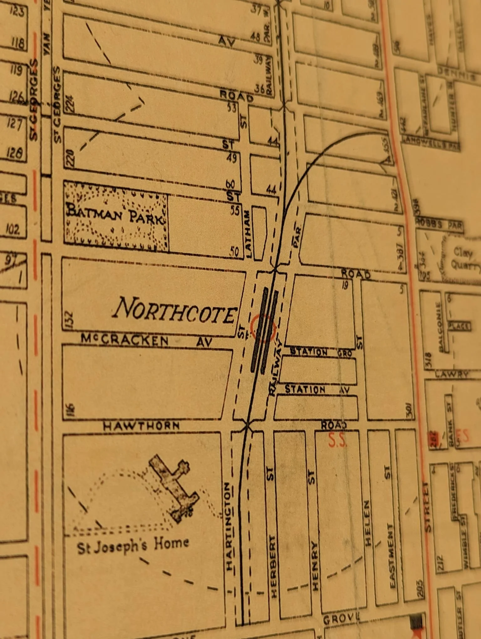 Image 2 of 5
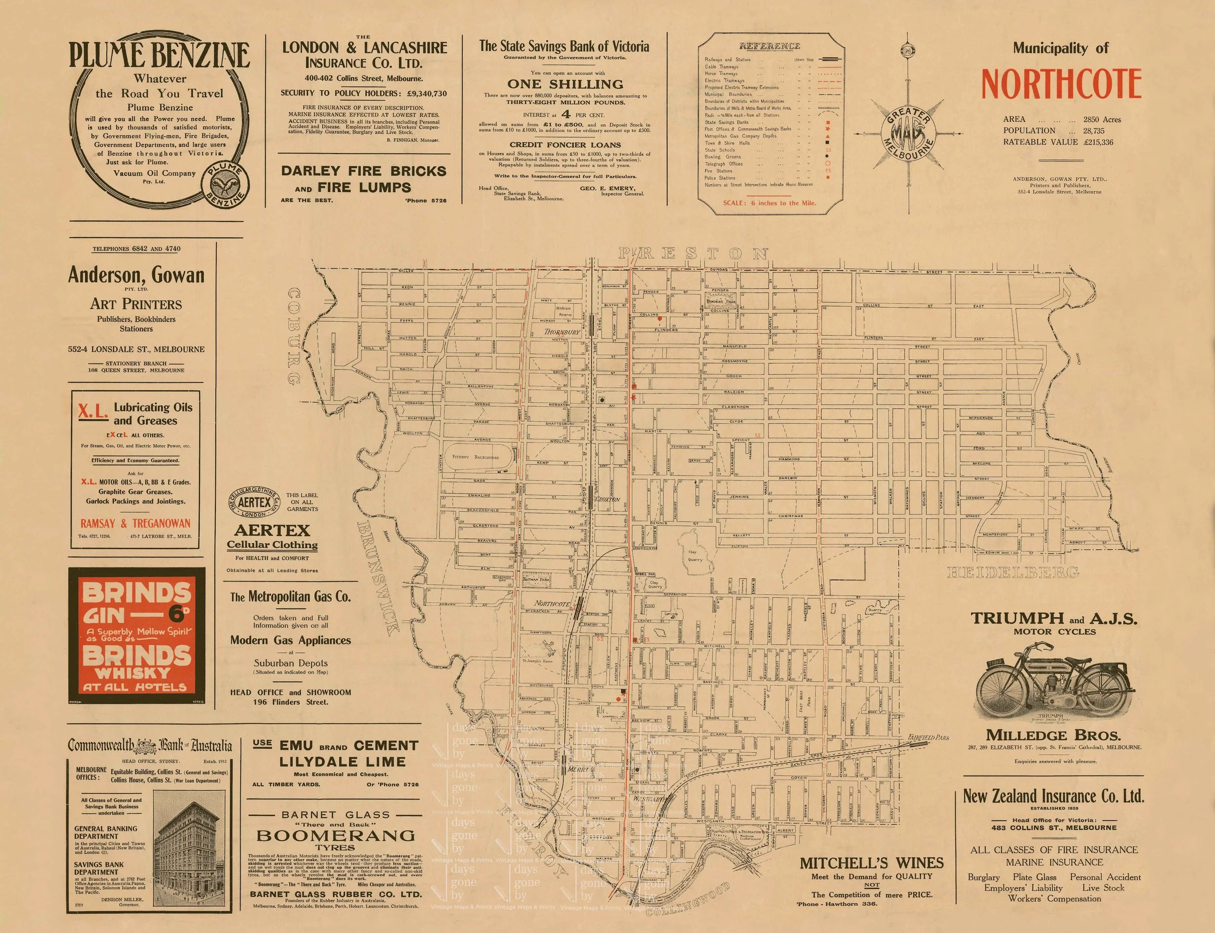 Image 3 of 5
 Image 4 of 5
 Image 5 of 5
This vintage map of modern day Northcote and Thornbury covers the Merri creek to the west and Darebin creek to the east. It includes landmarks such as the Northcote cricket ground (now the Bill Lawry oval), Penders park and Batman park. It shows historical and now non-existent sites such as the clay quarry on which all nations park now sits and a racecourse next to st Georges road.
Available in 11x14 (inches), 16x20 (inches) or 600x800 (mm) this print has been professionally restored to remove major blemishes, creases and marks from the original scanned document. Minor imperfections will remain to provide the character this vintage map exudes.
Prints are available as full bleed prints or with a white border. All frames are made in Melbourne and available in Black, White, Tasmanian Oak or Victorian Blackwood.
All prints are made to order - allow 4-7 business days for order to be dispatched after payment is received.